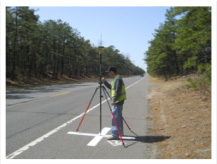
 M&S provides a broad range of surveying and mapping services to clients in both the public and private sectors. We focus on providing survey basemapping and right-of-way plans for public infrastructure projects, but we also offer a wide array of other services. Our survey staff is comprised of highly experienced licensed surveyors, field personnel, and survey technicians. Their combined expertise and attention to detail allows them to excel at any size survey project. Our basemapping and contouring services can be provided using Microstation, InRoads, Auto-CAD, Autodesk, and more, allowing us to meet our client’s needs. We also have experience with the drafting standards of many large transportation clients such as the NJDOT, PennDOT, NJ Turnpike Authority, and the Port Authority of NJ & NY.